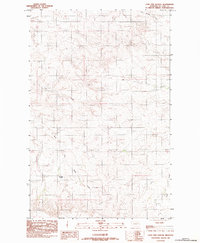
1983 Map of Lone Pine School
USGS Topo · Published 1983About this map
Lone Pine School sits at the heart of this high-plains landscape, a singular rural landmark in the sparsely populated terrain of McCone County. The area is defined by an intricate drainage system that carves through the Montana prairie, including the headwaters of Long Branch Creek in the north and the meandering path of Coal Creek through the central hills. To the south, the East Fork Sand Creek and Wolf Creek drain toward larger basins, illustrating the seasonal water patterns essential to life in this cattle and grain country. The map's detail reflects the vast township and range system, showing how section lines and remote drainage systems dictated the placement of early educational outposts like Lone Pine. It is a portrait of the isolation and quiet utility characteristic of Eastern Montana in the late twentieth century.
Find a feature on this map
8 named features on this map. Tap any name to fly to it.
Don’t see what you’re looking for? This feature index may not catch every label — zoom into the map to look around manually.
Map Details
Editions of this 1983 Lone Pine School Map
This is the sole edition of this map. No revisions or reprints were ever made.
Other maps of this area

1954 · Glendive
USGS Topo · 1:250,000

1957 · Glendive
USGS Topo · 1:250,000

1958 · Glendive
USGS Topo · 1:250,000

1983 · Hudiburgh Reservoir
USGS Topo · 1:24,000
1983 · Gady Coulee
USGS Topo · 1:24,000

1983 · Dailey Spring
USGS Topo · 1:24,000

1983 · Hudiburgh Reservoir NW
USGS Topo · 1:24,000

1983 · Beery Reservoir
USGS Topo · 1:24,000
1983 · Rock Creek
USGS Topo · 1:24,000
1983 · Antelope Creek Reservoir
USGS Topo · 1:24,000