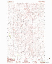
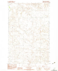
1983 Map of Sadie Coulee
USGS Topo · Published 1983About this map
Sadie Coulee and its intricate network of drainage channels dominate this McCone County landscape, revealing a highly eroded terrain characteristic of eastern Montana. The map highlights the reliance on water management in this arid ranching country, evidenced by the presence of Gass Reservoir and scattered wells. While the area lacks dense settlements, the naming conventions of features like Young Rosie Coulee, Dead Man Coulee, and John Coulee suggest a history of early cattle grazing and homesteading where local landmarks were identified by family names or notable incidents. Small traces of community life appear in the form of a cemetery, providing a point of interest for genealogists tracking early inhabitants of the region. The drainage patterns of Prairie Elk Creek and Porcupine Creek further illustrate the topographic complexity of this territory during the late 1970s and early 1980s.
Find a feature on this map
14 named features on this map. Tap any name to fly to it.
Don’t see what you’re looking for? This feature index may not catch every label — zoom into the map to look around manually.
Map Details
Editions of this 1983 Sadie Coulee Map
This is the sole edition of this map. No revisions or reprints were ever made.
Other maps of this area

1954 · Glendive
USGS Topo · 1:250,000

1957 · Glendive
USGS Topo · 1:250,000

1958 · Glendive
USGS Topo · 1:250,000
1983 · Figure Eight Creek
USGS Topo · 1:24,000
1983 · Turtle Creek
USGS Topo · 1:24,000

1983 · Pedigo Coulee
USGS Topo · 1:24,000

1983 · Dailey Spring
USGS Topo · 1:24,000

1983 · Hudiburgh Reservoir NW
USGS Topo · 1:24,000
1983 · Shade Creek
USGS Topo · 1:24,000
1983 · Emily Coulee
USGS Topo · 1:24,000