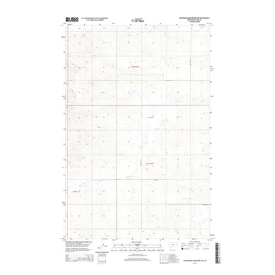
2014 Map of Hudiburgh Reservoir NW
USGS Topo · Published 2014About this map
Blackjack Spring provides a rare perennial water source in this high-plains landscape of McCone County, where the topography is defined by the winding drainages of Cow Cr and Duck Cr. This 2014 survey captures a sparsely populated ranching territory where local movement is dictated by a few critical thoroughfares. Routes like Sand Creek Rd, Thorgaard Rd, and Stoney Rd link the vast sections of the Public Land Survey System, specifically those in t23n r47e and t22n r47e. The map illustrates a rural settlement pattern where name-associated roads and remote springs serve as the primary landmarks for local geography and property boundaries.
Find a feature on this map
9 named features on this map. Tap any name to fly to it.
Don’t see what you’re looking for? This feature index may not catch every label — zoom into the map to look around manually.
Map Details
Editions of this 2014 Hudiburgh Reservoir NW Map
This is the sole edition of this map. No revisions or reprints were ever made.
Other maps of this area

1954 · Glendive
USGS Topo · 1:250,000

1957 · Glendive
USGS Topo · 1:250,000

1958 · Glendive
USGS Topo · 1:250,000

1983 · Haynie Reservoir
USGS Topo · 1:24,000

1983 · Hudiburgh Reservoir
USGS Topo · 1:24,000

1983 · Pedigo Coulee
USGS Topo · 1:24,000

1983 · Dailey Spring
USGS Topo · 1:24,000

1983 · North Fork Horse Creek
USGS Topo · 1:24,000

1983 · Hudiburgh Reservoir NW
USGS Topo · 1:24,000
1983 · Sadie Coulee
USGS Topo · 1:24,000