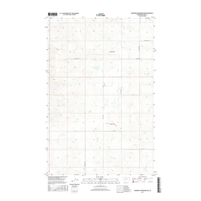
2017 Map of Hudiburgh Reservoir NW
USGS Topo · Published 2017About this map
Blackjack Spring provides a vital water source in this high-plains landscape of McCone County, where seasonal drainages like Cow Cr and Duck Cr carve intricate patterns through the terrain. The map captures a moment in the region's 21st-century development, marked by the presence of the Oil Field Svc Rd and several other rural transit routes. The township and range lines for t23n r47e and t22n r47e delineate the land management of the Big Dry country, showing how modern industry and ranching coexist in this sparsely populated portion of Montana. A network of local paths including Cow/Sand Loop, Cow Creek Rd, and Stoney Rd provides the primary access to the various sections of this wide-open landscape.
Find a feature on this map
12 named features on this map. Tap any name to fly to it.
Don’t see what you’re looking for? This feature index may not catch every label — zoom into the map to look around manually.
Map Details
Editions of this 2017 Hudiburgh Reservoir NW Map
This is the sole edition of this map. No revisions or reprints were ever made.
Other maps of this area

1954 · Glendive
USGS Topo · 1:250,000

1957 · Glendive
USGS Topo · 1:250,000

1958 · Glendive
USGS Topo · 1:250,000

1983 · Haynie Reservoir
USGS Topo · 1:24,000

1983 · Hudiburgh Reservoir
USGS Topo · 1:24,000

1983 · Pedigo Coulee
USGS Topo · 1:24,000

1983 · Dailey Spring
USGS Topo · 1:24,000

1983 · North Fork Horse Creek
USGS Topo · 1:24,000

1983 · Hudiburgh Reservoir NW
USGS Topo · 1:24,000
1983 · Sadie Coulee
USGS Topo · 1:24,000