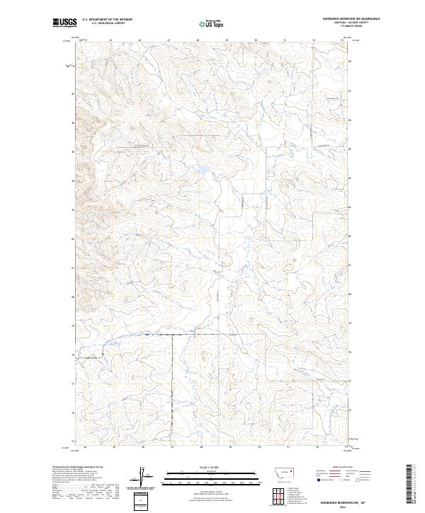
2024 Map of Hudiburgh Reservoir NW
USGS Topo · Published 2024About this map
Cow Creek and its many seasonal tributaries define this section of McCone County, Montana, where the drainage network carves through a landscape largely shaped by ranching and resource extraction. The 2024 survey illustrates a highly developed network of rural and industrial access ways, including the Oil Field Svc Rd, which points to the area's role in local energy production. Transportation in this corner of the state relies on a complex web of named tracks such as Stoney Rd and Cow Creek Rd, which navigate the elevation changes between the creek beds and the high plains. While the terrain is dominated by watercourses like Duck Creek, rare water sources such as Blackjack Spring provide vital landmarks for understanding the hydrology and land use patterns of this Montana range land.
Find a feature on this map
13 named features on this map. Tap any name to fly to it.
Don’t see what you’re looking for? This feature index may not catch every label — zoom into the map to look around manually.
Map Details
Editions of this 2024 Hudiburgh Reservoir NW Map
This is the sole edition of this map. No revisions or reprints were ever made.
Other maps of this area

1954 · Glendive
USGS Topo · 1:250,000

1957 · Glendive
USGS Topo · 1:250,000

1958 · Glendive
USGS Topo · 1:250,000

1983 · Haynie Reservoir
USGS Topo · 1:24,000

1983 · Hudiburgh Reservoir
USGS Topo · 1:24,000

1983 · Pedigo Coulee
USGS Topo · 1:24,000

1983 · Dailey Spring
USGS Topo · 1:24,000

1983 · North Fork Horse Creek
USGS Topo · 1:24,000

1983 · Hudiburgh Reservoir NW
USGS Topo · 1:24,000
1983 · Sadie Coulee
USGS Topo · 1:24,000