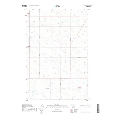
2020 Map of Hudiburgh Reservoir SE
USGS Topo · Published 2020About this map
N Fork Buffalo Cr and S Fork Buffalo Cr converge within this high plains landscape of McCone County, Montana. The terrain is defined by a dendritic network of drainages including Spring Cr, Duck Cr, and Lost Cr, which carve through the sectional divisions of the Public Land Survey System. Human infrastructure is limited to a sparse grid of gravel and dirt routes such as North Rd and Spring Creek Rd, reflecting the remote ranching character of the region. The map captures the specialized local geography through names like W Farm Loop and Buffalo Creek Rd, marking a landscape where transport and water management are dictated by the underlying coulees and ridges of the Missouri River watershed.
Find a feature on this map
18 named features on this map. Tap any name to fly to it.
Don’t see what you’re looking for? This feature index may not catch every label — zoom into the map to look around manually.
Map Details
Editions of this 2020 Hudiburgh Reservoir SE Map
This is the sole edition of this map. No revisions or reprints were ever made.
Other maps of this area

1954 · Glendive
USGS Topo · 1:250,000

1957 · Glendive
USGS Topo · 1:250,000

1958 · Glendive
USGS Topo · 1:250,000

1982 · Circle
USGS Topo · 1:100,000

1983 · Youngquist Mine
USGS Topo · 1:24,000

1983 · Haynie Reservoir
USGS Topo · 1:24,000

1983 · Hudiburgh Reservoir
USGS Topo · 1:24,000

1983 · Woodworth Hill
USGS Topo · 1:24,000

1983 · Hudiburgh Reservoir NW
USGS Topo · 1:24,000

1983 · Buffalo Creek
USGS Topo · 1:24,000