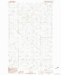
1983 Map of Hudiburgh Reservoir SE
USGS Topo · Published 1983About this map
North Fork Buffalo Creek and South Fork Buffalo Creek converge within this high plains landscape of McCone County, creating a complex network of seasonal drainages and coulees. Surveyed in the late 1970s and edited in the early 1980s, the map reveals a sparsely settled ranching environment defined by remote infrastructure. A notable landmark is the Grass Landing Strip, an essential piece of aviation history for large-scale Montana ranching operations. The terrain is further etched by the paths of Lost Creek and Spring Creek, showing how water dictated the placement of roads and homesteads across this eastern Montana reach. This provisional edition preserves the drainage patterns and isolated improvements of the era before more modern digital mapping was introduced.
Find a feature on this map
6 named features on this map. Tap any name to fly to it.
Don’t see what you’re looking for? This feature index may not catch every label — zoom into the map to look around manually.
Map Details
Editions of this 1983 Hudiburgh Reservoir SE Map
This is the sole edition of this map. No revisions or reprints were ever made.
Other maps of this area

1954 · Glendive
USGS Topo · 1:250,000

1957 · Glendive
USGS Topo · 1:250,000

1958 · Glendive
USGS Topo · 1:250,000

1982 · Circle
USGS Topo · 1:100,000

1983 · Youngquist Mine
USGS Topo · 1:24,000

1983 · Haynie Reservoir
USGS Topo · 1:24,000

1983 · Hudiburgh Reservoir
USGS Topo · 1:24,000

1983 · Woodworth Hill
USGS Topo · 1:24,000

1983 · Hudiburgh Reservoir NW
USGS Topo · 1:24,000

1983 · Buffalo Creek
USGS Topo · 1:24,000