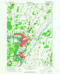
1966 Map of Hudson Falls
USGS Topo · Published 1968About this map
Hudson Falls and Fort Edward dominate the riverfront in this mid-1960s study, showcasing a landscape defined by industrial legacy and transit infrastructure. The Hudson River flows through the heart of the area, creating the falls at Bakers Falls and separating the communities as it wraps around Rogers Island. This era captures a period of growth and institutional development, evidenced by the campus of Adirondack Community College and the layout of the Warren County Airport to the northwest.
Find a feature on this map
59 named features on this map. Tap any name to fly to it.
Don’t see what you’re looking for? This feature index may not catch every label — zoom into the map to look around manually.
Map Details
Editions of this 1966 Hudson Falls Map
3 editions found
Other maps of this area

1893 · Fort Ann
USGS Topo · 1:62,500

1895 · Cambridge
USGS Topo · 1:62,500

1895 · Fort Ann
USGS Topo · 1:62,500

1895 · Glens Falls
USGS Topo · 1:62,500

1897 · Glens Falls
USGS Topo · 1:62,500

1898 · Cambridge
USGS Topo · 1:62,500

1898 · Fort Ann
USGS Topo · 1:62,500

1900 · Schuylerville
USGS Topo · 1:62,500

1901 · Fort Ann
USGS Topo · 1:62,500

1901 · Cambridge
USGS Topo · 1:62,500