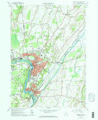
1966 Map of Hudson Falls
USGS Topo · Published 1984About this map
The Hudson River dictates the industrial and civic layout of the eastern New York landscape, carving through the tri-county border area of Washington, Warren, and Saratoga. In the mid-1960s, the twin industrial centers of Hudson Falls and Fort Edward show a dense grid of residential streets like Martindale Ave and Notre Dame St, supported by several local schools including the Central High Sch and Jr High Sch.
Find a feature on this map
96 named features on this map. Tap any name to fly to it.
Don’t see what you’re looking for? This feature index may not catch every label — zoom into the map to look around manually.
Map Details
Editions of this 1966 Hudson Falls Map
3 editions found
Other maps of this area

1893 · Fort Ann
USGS Topo · 1:62,500

1895 · Cambridge
USGS Topo · 1:62,500

1895 · Fort Ann
USGS Topo · 1:62,500

1895 · Glens Falls
USGS Topo · 1:62,500

1897 · Glens Falls
USGS Topo · 1:62,500

1898 · Cambridge
USGS Topo · 1:62,500

1898 · Fort Ann
USGS Topo · 1:62,500

1900 · Schuylerville
USGS Topo · 1:62,500

1901 · Fort Ann
USGS Topo · 1:62,500

1901 · Cambridge
USGS Topo · 1:62,500