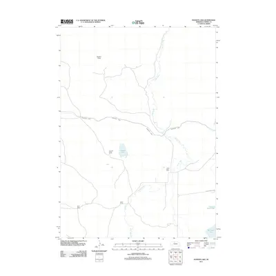
2011 Map of Hudson Lake
USGS Topo · Published 2011About this map
Hudson Lake and the meandering path of Gordon Creek define the geography of this part of Cherry County, Nebraska. This high-plains landscape is characterized by its significant ranching presence, with family-named operations such as Harms Ranch, Gordon Valley Ranch, and the Sunny Slope Ranch established across the terrain. The presence of the Ainsworth Canal cutting across the north-central portion of the map highlights the critical role of water management in supporting this cattle-country economy.
Find a feature on this map
11 named features on this map. Tap any name to fly to it.
Don’t see what you’re looking for? This feature index may not catch every label — zoom into the map to look around manually.
Map Details
Editions of this 2011 Hudson Lake Map
This is the sole edition of this map. No revisions or reprints were ever made.
Other maps of this area

1950 · Simeon
USGS Topo · 1:62,500

1950 · Kennedy
USGS Topo · 1:62,500

1950 · Kilgore
USGS Topo · 1:62,500

1950 · Valentine
USGS Topo · 1:62,500

1957 · Valentine
USGS Topo · 1:250,000

1959 · Valentine
USGS Topo · 1:250,000

1983 · Valentine SW
USGS Topo · 1:24,000

1983 · Valentine South
USGS Topo · 1:24,000
1985 · Kilgore SE
USGS Topo · 1:24,000

1985 · Valentine
USGS Topo · 1:100,000