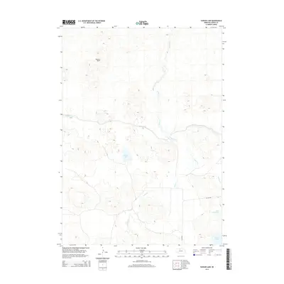
2014 Map of Hudson Lake
USGS Topo · Published 2014About this map
The Nebraska Sandhills of Cherry County define this landscape, where the meandering path of Gordon Cr cuts through the undulating terrain. A significant human-made feature, the Ainsworth Canal, traverses the central part of the quadrangle, reflecting the region's reliance on water management for ranching and agriculture. The map is punctuated by several significant water bodies, most notably Hudson Lake and the pair of Big Alkali Lake and Little Alkali Lake in the southeast corner.
Find a feature on this map
8 named features on this map. Tap any name to fly to it.
Don’t see what you’re looking for? This feature index may not catch every label — zoom into the map to look around manually.
Map Details
Editions of this 2014 Hudson Lake Map
This is the sole edition of this map. No revisions or reprints were ever made.
Other maps of this area

1950 · Simeon
USGS Topo · 1:62,500

1950 · Kennedy
USGS Topo · 1:62,500

1950 · Kilgore
USGS Topo · 1:62,500

1950 · Valentine
USGS Topo · 1:62,500

1957 · Valentine
USGS Topo · 1:250,000

1959 · Valentine
USGS Topo · 1:250,000

1983 · Valentine SW
USGS Topo · 1:24,000

1983 · Valentine South
USGS Topo · 1:24,000
1985 · Kilgore SE
USGS Topo · 1:24,000

1985 · Valentine
USGS Topo · 1:100,000