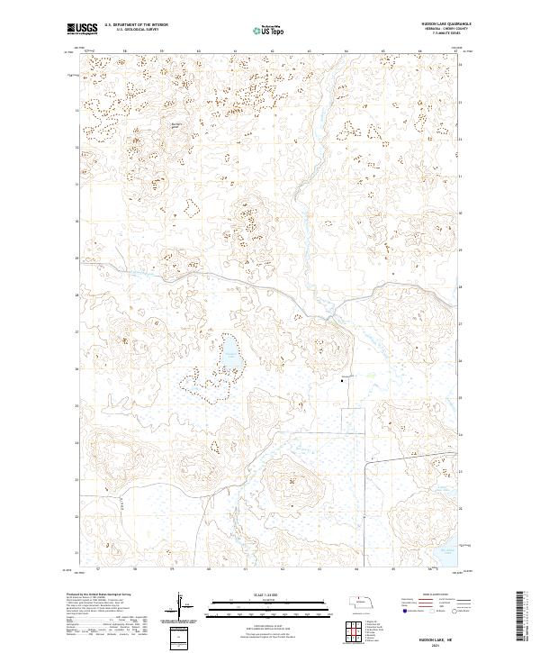
2021 Map of Hudson Lake
USGS Topo · Published 2021About this map
Gordon Cr meanders through this portion of the Sandhills in Cherry County, carving a path through a landscape defined by expansive wetlands and natural basins. The central feature, Hudson Lake, is surrounded by an intricate network of marshes, illustrating the region's complex hydrology. To the south, the terrain descends toward the significant water bodies of Big Alkali Lake and Little Alkali Lake. Human presence is marked by the remote Simeon Cem and the Ainsworth Canal, a critical piece of water infrastructure cutting across the northern reaches. The presence of Rustlers Roost suggests a storied local history in this isolated ranching country, where large township blocks like t31n r29w define the cadastral grid. This survey provides a clear view of the traditional land divisions and the vital water sources that have sustained the cattle industry in this unique Nebraska environment.
Find a feature on this map
12 named features on this map. Tap any name to fly to it.
Don’t see what you’re looking for? This feature index may not catch every label — zoom into the map to look around manually.
Map Details
Editions of this 2021 Hudson Lake Map
This is the sole edition of this map. No revisions or reprints were ever made.
Other maps of this area

1950 · Simeon
USGS Topo · 1:62,500

1950 · Kennedy
USGS Topo · 1:62,500

1950 · Kilgore
USGS Topo · 1:62,500

1950 · Valentine
USGS Topo · 1:62,500

1957 · Valentine
USGS Topo · 1:250,000

1959 · Valentine
USGS Topo · 1:250,000

1983 · Valentine SW
USGS Topo · 1:24,000

1983 · Valentine South
USGS Topo · 1:24,000
1985 · Kilgore SE
USGS Topo · 1:24,000

1985 · Valentine
USGS Topo · 1:100,000