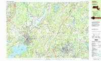
1997 Map of Hudson
USGS Topo · Published 1999About this map
The Wachusett Reservoir and the industrial corridors of the Nashua River and Assabet River anchor this late-twentieth-century study of central Massachusetts. The landscape reflects a dense history of manufacturing and transport, where the Boston & Maine RR tracks once connected established mill villages like Ponakin Mill and Gleasondale. Significant public lands shape the topography, including the Fort Devens Military Reservation to the north and the sprawling Bolton Flats State Wildlife Management Area along the river bottomlands.
Find a feature on this map
128 named features on this map. Tap any name to fly to it.
Don’t see what you’re looking for? This feature index may not catch every label — zoom into the map to look around manually.
Map Details
Editions of this 1997 Hudson Map
This is the sole edition of this map. No revisions or reprints were ever made.
Other maps of this area

1885 · Worcester
USGS Topo · 1:62,500

1886 · Worcester
USGS Topo · 1:62,500

1886 · Lowell
USGS Topo · 1:62,500

1886 · Framingham
USGS Topo · 1:62,500

1887 · Marlboro
USGS Topo · 1:62,500

1887 · Fitchburg
USGS Topo · 1:62,500

1889 · Marlboro
USGS Topo · 1:62,500

1889 · Fitchburg
USGS Topo · 1:62,500

1889 · Framingham
USGS Topo · 1:62,500

1892 · Worcester
USGS Topo · 1:62,500