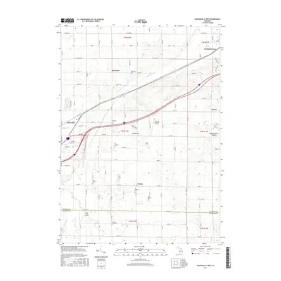
2017 Map of Hudsonville West
USGS Topo · Published 2017About this map
The agricultural and residential landscape of Ottawa County is clearly defined on this 2017 survey, where the Macatawa River and its various branches, including the S Br Macatawa River and Brower Drain, shape the drainage of the region. This area reflects a deep-rooted Dutch heritage, evidenced by the cluster of long-established settlements such as Vriesland, Zutphen, and Drenthe. The map is particularly significant for genealogical research, documenting numerous burial sites like the West Drenthe Cem, Old Vriesland Cem, and the small Van Dam Family Cem.
Find a feature on this map
54 named features on this map. Tap any name to fly to it.
Don’t see what you’re looking for? This feature index may not catch every label — zoom into the map to look around manually.
Map Details
Editions of this 2017 Hudsonville West Map
This is the sole edition of this map. No revisions or reprints were ever made.
Other maps of this area

1928 · Fennville
USGS Topo · 1:62,500

1929 · Holland
USGS Topo · 1:62,500

1931 · Fennville
USGS Topo · 1:62,500

1932 · Holland
USGS Topo · 1:62,500

1958 · Allendale
USGS Topo · 1:24,000

1958 · Allegan
USGS Topo · 1:62,500

1958 · Grandville
USGS Topo · 1:62,500

1958 · Grandville
USGS Topo · 1:24,000

1958 · Racine
USGS Topo · 1:250,000

1958 · Grand Rapids
USGS Topo · 1:250,000