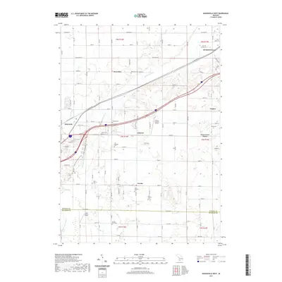
2019 Map of Hudsonville West
USGS Topo · Published 2019About this map
Vriesland and Drenthe serve as the cultural heart of this rural landscape between Zeeland and Hudsonville, where Dutch heritage remains visible in the high density of community cemeteries. The map details a transition from intensive agricultural use to modern conservation, anchored by the Upper Macatawa Natural Area along the Macatawa River. Genealogists will find an exceptional record of local family history through numerous burial grounds, including the Old Vriesland Cem, Old Drenthe Cem, and the private Van Dam Family Cem. The landscape is further defined by the legacy of the regional rail and road network, with sites like Forest Grove Station and the thoroughfare of Chicago Dr marking historic corridors of travel. Aviation history is also represented by small local facilities like Ottawa Executive Airport and Curt's Place Airport.
Find a feature on this map
53 named features on this map. Tap any name to fly to it.
Don’t see what you’re looking for? This feature index may not catch every label — zoom into the map to look around manually.
Map Details
Editions of this 2019 Hudsonville West Map
This is the sole edition of this map. No revisions or reprints were ever made.
Other maps of this area

1928 · Fennville
USGS Topo · 1:62,500

1929 · Holland
USGS Topo · 1:62,500

1931 · Fennville
USGS Topo · 1:62,500

1932 · Holland
USGS Topo · 1:62,500

1958 · Allendale
USGS Topo · 1:24,000

1958 · Allegan
USGS Topo · 1:62,500

1958 · Grandville
USGS Topo · 1:62,500

1958 · Grandville
USGS Topo · 1:24,000

1958 · Racine
USGS Topo · 1:250,000

1958 · Grand Rapids
USGS Topo · 1:250,000