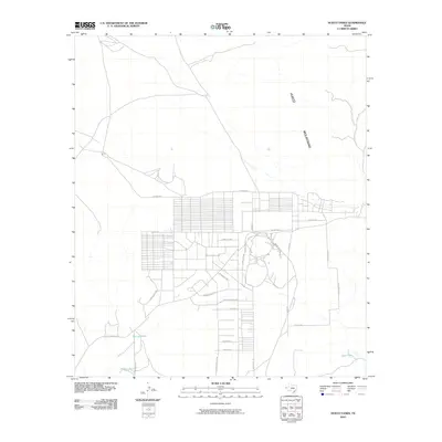
2010 Map of Hueco Tanks
USGS Topo · Published 2010About this map
The eastern reaches of El Paso County near the Hueco Mountains reveal a grid of residential developments organized against a landscape defined by historic transit corridors and arid-land water management. This 2010 topographic record illustrates the layout of Hueco Mountain Estates, where long avenues like Carinha Ave and London Ave stretch across the desert floor. The map is particularly notable for tracing the legacy of 19th-century westward expansion, clearly marking the Old Butterfield Trl and the Overland Stage Rd. These historic routes intersect with modern access points like State Park Rd and Park Road 68. Scattered across the terrain, essential water features such as Ramons Tank, Hidden Tank, and Deer Tank point to the critical role of livestock and wildlife watering holes in this high-desert environment east of the city.
Find a feature on this map
26 named features on this map. Tap any name to fly to it.
Don’t see what you’re looking for? This feature index may not catch every label — zoom into the map to look around manually.
Map Details
Editions of this 2010 Hueco Tanks Map
This is the sole edition of this map. No revisions or reprints were ever made.
Other maps of this area

1896 · El Paso
USGS Topo · 1:125,000

1903 · Cerro Alto
USGS Topo · 1:125,000

1908 · El Paso
USGS Topo · 1:125,000

1939 · Heuco Tanks
USGS Topo · 1:62,500

1940 · Heuco Tanks
USGS Topo · 1:62,500

1940 · Bassett Lake
USGS Topo · 1:62,500

1941 · Heuco Mountains
USGS Topo · 1:62,500

1941 · Desert
USGS Topo · 1:62,500

1943 · Desert
USGS Topo · 1:62,500

1943 · Heuco Mountains
USGS Topo · 1:62,500
Featured Places
- Hueco Mountain Estates Number 2 Colonia, TX
- Hueco Mountain Estates Number 8 Colonia, TX
- Hueco Mountain Estates Number 1 Colonia, TX
- Hueco Mountain Estates Number 3 Colonia, TX
- Hueco Mountain Estates Number 4 Colonia, TX