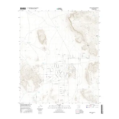
2016 Map of Hueco Tanks
USGS Topo · Published 2016About this map
The Hueco Mountains rise sharply above a desert landscape defined by essential water catchment sites and historic western transit corridors. This 2016 survey highlights a geography where survival and movement were traditionally dictated by the presence of natural basins and seasonal reservoirs, such as Hueco Tanks and Jarilla Tank. The modern road network, including residential streets like Roma Ave and Bettina Ave, overlaps with significant historical pathways. Traces of the frontier era are preserved through labels for the Old Butterfield Trl, the Overland Stage Rd, and Pony Express Rd. This intersection of contemporary living and pioneer-era infrastructure is further marked by Hueco Tanks Park, while the surrounding terrain is etched by features like Hackberry Canyon and numerous livestock tanks including Kerby Tank and Deer Tank.
Find a feature on this map
70 named features on this map. Tap any name to fly to it.
Don’t see what you’re looking for? This feature index may not catch every label — zoom into the map to look around manually.
Map Details
Editions of this 2016 Hueco Tanks Map
This is the sole edition of this map. No revisions or reprints were ever made.
Other maps of this area

1896 · El Paso
USGS Topo · 1:125,000

1903 · Cerro Alto
USGS Topo · 1:125,000

1908 · El Paso
USGS Topo · 1:125,000

1939 · Heuco Tanks
USGS Topo · 1:62,500

1940 · Heuco Tanks
USGS Topo · 1:62,500

1940 · Bassett Lake
USGS Topo · 1:62,500

1941 · Heuco Mountains
USGS Topo · 1:62,500

1941 · Desert
USGS Topo · 1:62,500

1943 · Desert
USGS Topo · 1:62,500

1943 · Heuco Mountains
USGS Topo · 1:62,500
Featured Places
- Hueco Mountain Estates Number 2 Colonia, TX
- Hueco Mountain Estates Number 8 Colonia, TX
- Hueco Mountain Estates Number 1 Colonia, TX
- Hueco Mountain Estates Number 3 Colonia, TX
- Hueco Mountain Estates Number 4 Colonia, TX