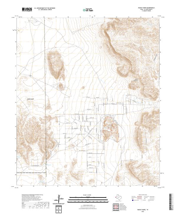
2022 Map of Hueco Tanks
USGS Topo · Published 2022About this map
The Hueco Mountains define the high terrain of this El Paso County landscape, where water management is visible through a series of named catchments including Ross Tank, San Juan Tank, and Deer Tank. The area is characterized by the intersection of recreational space and recent residential expansion. Within Hueco Tanks Park, hikers and researchers can trace the Basin Area Trl and East Spur Trl through the rocky outcrops. To the west of the mountains, a suburban grid has materialized, featuring streets like Casa Blanca Ave and Mobeetie Ave. This network of roads, including the historically named Overland Stage Rd, highlights the shift from open desert range to a structured residential community while preserving access to the canyons and peaks that have long served as vital water sources in the arid climate.
Find a feature on this map
68 named features on this map. Tap any name to fly to it.
Don’t see what you’re looking for? This feature index may not catch every label — zoom into the map to look around manually.
Map Details
Editions of this 2022 Hueco Tanks Map
This is the sole edition of this map. No revisions or reprints were ever made.
Other maps of this area

1896 · El Paso
USGS Topo · 1:125,000

1903 · Cerro Alto
USGS Topo · 1:125,000

1908 · El Paso
USGS Topo · 1:125,000

1939 · Heuco Tanks
USGS Topo · 1:62,500

1940 · Heuco Tanks
USGS Topo · 1:62,500

1940 · Bassett Lake
USGS Topo · 1:62,500

1941 · Heuco Mountains
USGS Topo · 1:62,500

1941 · Desert
USGS Topo · 1:62,500

1943 · Desert
USGS Topo · 1:62,500

1943 · Heuco Mountains
USGS Topo · 1:62,500
Featured Places
- Hueco Mountain Estates Number 2 Colonia, TX
- Hueco Mountain Estates Number 8 Colonia, TX
- Hueco Mountain Estates Number 3 Colonia, TX
- Hueco Mountain Estates Number 4 Colonia, TX
- Hueco Mountain Estates Number 5 Colonia, TX