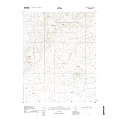
2020 Map of Huerfanito Peak
USGS Topo · Published 2020About this map
Huerfanito Peak rises prominently above a network of high mesas and deep drainages in the high desert of San Juan County. This 2020 topographical study details the intricate erosion patterns and landforms that define the region, including Harris Mesa and Muñoz Canyon. Remote infrastructure is traced through local routes like RD 7175 and RD 7225, which navigate the broken terrain between Angel Peak and the southern reaches of Jacquez Canyon. Water resources are scarce in this arid landscape, marked specifically by Armenta Canyon Spring nestled within Armenta Canyon. The map provides a clear record of the Public Land Survey System, showing the township and range lines of the Navajo Reservoir area's southern hinterlands.
Find a feature on this map
18 named features on this map. Tap any name to fly to it.
Don’t see what you’re looking for? This feature index may not catch every label — zoom into the map to look around manually.
Map Details
Editions of this 2020 Huerfanito Peak Map
This is the sole edition of this map. No revisions or reprints were ever made.
Other maps of this area

1889 · Largo
USGS Topo · 1:250,000

1895 · Largo
USGS Topo · 1:250,000

1954 · Aztec
USGS Topo · 1:250,000

1958 · Aztec
USGS Topo · 1:250,000

1959 · Gould Pass
USGS Topo · 1:62,500

1959 · Nageezi
USGS Topo · 1:62,500

1960 · Bloomfield
USGS Topo · 1:62,500

1962 · Aztec
USGS Topo · 1:250,000

1965 · Aztec
USGS Topo · 1:250,000
1966 · Huerfano Trading Post NW
USGS Topo · 1:24,000