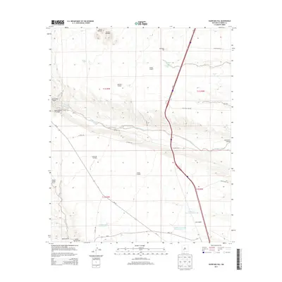
2013 Map of Huerfano Hill
USGS Topo · Published 2013About this map
Huerfano Hill rises as a prominent landmark in this arid Sierra County landscape, where water management defines the human footprint on the high desert. The map reveals an intricate network of tanks and reservoirs, such as Mn Chavez Reservoir Number 1 and the Cuehillo Community Allotment Reservoir, which were essential for ranching operations in this part of New Mexico. These man-made features are scattered among deep-cut natural drainages like Alamosa Creek and Questa Blanca Canyon. Transport through this territory is marked by the winding path of NM-1 and various rural connectors like Co Road co29, which follow the contours of the land between the Sierras Mediano and the flats. For those studying land use, the presence of specific allotment reservoirs and tanks like Sixteen Tank illustrates the historical importance of securing water rights and resources in an otherwise unforgiving environment.
Find a feature on this map
34 named features on this map. Tap any name to fly to it.
Don’t see what you’re looking for? This feature index may not catch every label — zoom into the map to look around manually.
Map Details
Editions of this 2013 Huerfano Hill Map
This is the sole edition of this map. No revisions or reprints were ever made.
Other maps of this area

1954 · Tularosa
USGS Topo · 1:250,000

1958 · Tularosa
USGS Topo · 1:250,000

1958 · Elephant Butte
USGS Topo · 1:24,000

1959 · Engle
USGS Topo · 1:62,500

1961 · Priest Tank
USGS Topo · 1:24,000

1961 · Huerfano Hill
USGS Topo · 1:24,000

1961 · Sierra Fijardo
USGS Topo · 1:24,000

1961 · Black Bluffs
USGS Topo · 1:24,000

1961 · Williamsburg NW
USGS Topo · 1:24,000

1961 · Monticello
USGS Topo · 1:24,000