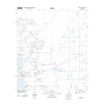
2013 Map of Huffman
USGS Topo · Published 2013About this map
Huffman serves as the central hub of this East Texas landscape, positioned at a critical junction of road and water just east of Lake Houston. The 2013 survey illustrates the residential expansion along the lake's eastern shore, characterized by neighborhoods like Lakewood Heights and Lakeside Manor. Beyond the suburban fringe, the land retains its drainage-focused rural character, defined by Luce Bayou and a series of named gullies including Mexican Gully and John Young Gully.
Find a feature on this map
151 named features on this map. Tap any name to fly to it.
Don’t see what you’re looking for? This feature index may not catch every label — zoom into the map to look around manually.
Map Details
Editions of this 2013 Huffman Map
This is the sole edition of this map. No revisions or reprints were ever made.
Other maps of this area

1916 · Crosby
USGS Topo · 1:24,000

1916 · Harmaston
USGS Topo · 1:24,000

1916 · Moonshine Hill
USGS Topo · 1:24,000

1916 · Huffman
USGS Topo · 1:24,000

1919 · Crosby
USGS Topo · 1:31,680

1920 · Harmaston
USGS Topo · 1:31,680

1920 · Moonshine Hill
USGS Topo · 1:31,680

1920 · Huffman
USGS Topo · 1:31,680

1943 · Liberty
USGS Topo · 1:125,000
1944 · Crosby
USGS Topo · 1:31,680