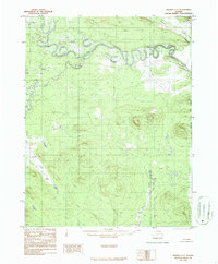
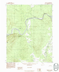
1986 Map of Hughes C-1
USGS Topo · Published 1986About this map
The Alatna River dominates the northern landscape of this interior Alaska territory, where its tight, serpentine oxbows and abandoned channels reveal a shifting fluvial environment. This 1986 survey, based on photography from the early 1970s, captures a wilderness devoid of roads or permanent settlements. Significant tributaries like Sinyalak Creek and Siruk Creek feed into the main river system from the north and west, while the southern terrain is defined by the drainage of Henry Creek. This map is a primary reference for the Kateel River Meridian boundary, which marks the eastern edge of the quadrangle. The lack of infrastructure highlights the natural hydrology of the Yukon-Koyukuk region before contemporary development, preserving the original courses of these waterways as they were recorded during the mid-to-late twentieth century.
Find a feature on this map
5 named features on this map. Tap any name to fly to it.
Don’t see what you’re looking for? This feature index may not catch every label — zoom into the map to look around manually.
Map Details
Editions of this 1986 Hughes C-1 Map
This is the sole edition of this map. No revisions or reprints were ever made.
Other maps of this area

1951 · Hughes
USGS Topo · 1:250,000

1951 · Bettles
USGS Topo · 1:250,000

1956 · Hughes
USGS Topo · 1:250,000

1956 · Bettles
USGS Topo · 1:250,000

1964 · Hughes
USGS Topo · 1:250,000

1965 · Hughes
USGS Topo · 1:250,000
1970 · Bettles D-6
USGS Topo · 1:63,360
1970 · Bettles B-6
USGS Topo · 1:63,360
1970 · Bettles C-6
USGS Topo · 1:63,360
1986 · Hughes B-1
USGS Topo · 1:63,360