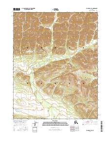
2016 Map of Hughes D-1 SE
USGS Topo · Published 2016About this map
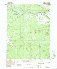
Alatna Hills dominate the northern terrain of this interior Alaska quadrangle, their contours revealing a landscape of steep elevations and deep drainage basins. The primary watercourse, Sinyalak Cr, snakes through the central and southern reaches, defining the natural path for runoff in this remote wilderness. The map is primarily structured by the grid of the Public Land Survey System, showing the junctions of t17n r26e, t17n r27e, t16n r26e, and t16n r27e. This 2016 survey captures a region defined by its topography rather than human infrastructure, serving as a baseline for understanding the physical geography of the Yukon-Koyukuk region before any significant modern development or trail-making was recorded in the official survey.
Find a feature on this map
6 named features on this map. Tap any name to fly to it.
Don’t see what you’re looking for? This feature index may not catch every label — zoom into the map to look around manually.
Map Details
Editions of this 2016 Hughes D-1 SE Map
This is the sole edition of this map. No revisions or reprints were ever made.
Other maps of this area

1951 · Hughes
USGS Topo · 1:250,000

1951 · Bettles
USGS Topo · 1:250,000

1956 · Hughes
USGS Topo · 1:250,000

1956 · Bettles
USGS Topo · 1:250,000

1964 · Hughes
USGS Topo · 1:250,000

1965 · Hughes
USGS Topo · 1:250,000
1970 · Bettles D-6
USGS Topo · 1:63,360
1970 · Bettles C-6
USGS Topo · 1:63,360
1986 · Hughes D-1
USGS Topo · 1:63,360
1986 · Hughes C-1
USGS Topo · 1:63,360