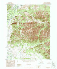
1986 Map of Hughes D-1
USGS Topo · Published 1986About this map
The Alatna River snakes through the western portion of this terrain, marking a distinct corridor against the prominent Alatna Hills that dominate the central and eastern landscape. Several drainages, including Helpmejack Creek in the northwest and Rockybottom Creek to the north, define the watershed patterns of this interior region. The lack of roads or established trails on this 1980s provisional edition emphasizes the isolation of the area, where the Kateel River Meridian Boundary provides one of the few formal survey markers across the topography. Smaller waterways like Sinyalak Creek and Chebanika Creek carve through the southern slopes, illustrating the complex drainage network feeding into the larger river systems of the Yukon-Koyukuk region.
Find a feature on this map
7 named features on this map. Tap any name to fly to it.
Don’t see what you’re looking for? This feature index may not catch every label — zoom into the map to look around manually.
Map Details
Editions of this 1986 Hughes D-1 Map
This is the sole edition of this map. No revisions or reprints were ever made.
Other maps of this area

1951 · Hughes
USGS Topo · 1:250,000

1951 · Bettles
USGS Topo · 1:250,000

1951 · Survey Pass
USGS Topo · 1:250,000

1951 · Wiseman
USGS Topo · 1:250,000

1956 · Hughes
USGS Topo · 1:250,000

1956 · Bettles
USGS Topo · 1:250,000

1956 · Wiseman
USGS Topo · 1:250,000

1956 · Survey Pass
USGS Topo · 1:250,000

1964 · Survey Pass
USGS Topo · 1:250,000

1964 · Wiseman
USGS Topo · 1:250,000