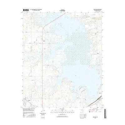
2016 Map of Hugo Dam
USGS Topo · Published 2016About this map
Hugo Lake dominates the landscape of southeastern Oklahoma, created by the Hugo Dam situated at the southern end of the reservoir along the Kiamichi River. This 2016 survey illustrates the extensive shoreline and various access points, including the Hugo Lake Boat Access Rd and the Hugo Lake Armadillo Rd. Smaller communities like Messer, Virgil, and Sawyer are dispersed around the water's edge, reflecting a rural settlement pattern deeply connected to the local hydrology. Genealogists and local historians can find family-named landmarks and resting places such as Messer Cem and Dixon Chapel Cem. The map reveals the intricate network of creeks that feed the lake, including N Fork Holly Cr, S Fork Holly Cr, and Salt Cr, which define the low-lying drainage basins of Choctaw County.
Find a feature on this map
42 named features on this map. Tap any name to fly to it.
Don’t see what you’re looking for? This feature index may not catch every label — zoom into the map to look around manually.
Map Details
Editions of this 2016 Hugo Dam Map
This is the sole edition of this map. No revisions or reprints were ever made.
Other maps of this area

1901 · Antlers
USGS Topo · 1:125,000

1901 · Alikchi
USGS Topo · 1:125,000

1903 · Paris
USGS Topo · 1:125,000

1912 · Antlers
USGS Topo · 1:125,000

1925 · Antlers
USGS Topo · 1:125,000

1948 · Grant
USGS Topo · 1:62,500

1949 · Grant
USGS Topo · 1:62,500

1950 · Mcalester
USGS Topo · 1:250,000

1951 · Frogville
USGS Topo · 1:24,000

1951 · Shoals
USGS Topo · 1:24,000