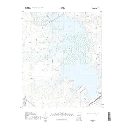
2019 Map of Hugo Dam
USGS Topo · Published 2019About this map
Hugo Lake dominates this Choctaw County landscape, its expansive waters formed by the construction of the Hugo Dam at the Kiamichi River. This 2019 survey documents the intricate shoreline and the surrounding rural communities that define the region northeast of the city of Hugo. The map provides significant detail for genealogists and local historians, capturing the locations of the Messer Cem and Dixon Chapel Cem, alongside smaller settlements like Messer, Sawyer, and Virgil. The hydrological network is well-defined, showing the paths of the N Fork Holly Cr, S Fork Holly Cr, and several smaller tributaries such as Dixon Br and Turnbull Cr. Access to the lake's recreational areas is noted through specific routes like the Hugo Lake Boat Access Rd and Hugo Lake Armadillo Rd, reflecting the modern infrastructure supporting the area's reservoir-based geography.
Find a feature on this map
60 named features on this map. Tap any name to fly to it.
Don’t see what you’re looking for? This feature index may not catch every label — zoom into the map to look around manually.
Map Details
Editions of this 2019 Hugo Dam Map
This is the sole edition of this map. No revisions or reprints were ever made.
Other maps of this area

1901 · Antlers
USGS Topo · 1:125,000

1901 · Alikchi
USGS Topo · 1:125,000

1903 · Paris
USGS Topo · 1:125,000

1912 · Antlers
USGS Topo · 1:125,000

1925 · Antlers
USGS Topo · 1:125,000

1948 · Grant
USGS Topo · 1:62,500

1949 · Grant
USGS Topo · 1:62,500

1950 · Mcalester
USGS Topo · 1:250,000

1951 · Frogville
USGS Topo · 1:24,000

1951 · Shoals
USGS Topo · 1:24,000