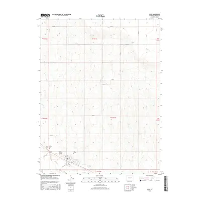
2016 Map of Hugo
USGS Topo · Published 2016About this map
The town of Hugo serves as the focal point of this high-plains landscape, situated along the southern edge of the survey where a grid of streets including 1st St and 4th St meets CO Hwy 109. The map reveals a high density of burial sites for a rural area, including Hugo Evergreen Cem, Mount Calvary Cem, and the more distant Hugo Old Cem. A particularly specific historical marker is the Doctor A H Coulson Grave, located just north of the town center.
Find a feature on this map
38 named features on this map. Tap any name to fly to it.
Don’t see what you’re looking for? This feature index may not catch every label — zoom into the map to look around manually.
Map Details
Editions of this 2016 Hugo Map
This is the sole edition of this map. No revisions or reprints were ever made.
Other maps of this area

1891 · Limon
USGS Topo · 1:125,000

1892 · Limon
USGS Topo · 1:125,000

1954 · Limon
USGS Topo · 1:250,000

1957 · Limon
USGS Topo · 1:250,000

1958 · Limon
USGS Topo · 1:250,000

1978 · Clifford
USGS Topo · 1:24,000

1979 · Sevenmile Ranch
USGS Topo · 1:24,000
1979 · Clifford
USGS Topo · 1:24,000

1979 · Arriba
USGS Topo · 1:24,000
1979 · Barron Creek
USGS Topo · 1:24,000