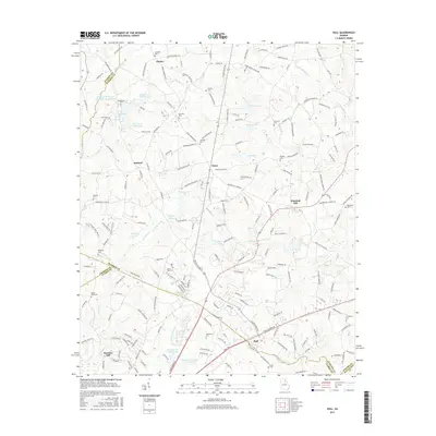
2017 Map of Hull
USGS Topo · Published 2017About this map
Hull and the surrounding agricultural uplands of Madison and Clarke Counties are defined by a network of small family-named cemeteries and rural settlements. This 2017 survey shows the transition from the old mill economy at Barretts Mill and Seagraves Mill Pond toward modern residential development near the northern edges of Athens. Local history is etched into the landscape through many family burial grounds, including the Chandler, Matthews, and Thompson cemeteries. The topography is shaped by the numerous tributaries of the Sandy Creek and Trail Creek system, which feed several reservoirs like Muse Lake and Sanford Lake. The intersection of Danielsville Road and Hull Road marks the community core, while outlying areas such as Diamond Hill and Planter maintain a more dispersed character, connected by old routes like Nowhere Road and Sam Swindle Road.
Find a feature on this map
200 named features on this map. Tap any name to fly to it.
Don’t see what you’re looking for? This feature index may not catch every label — zoom into the map to look around manually.
Map Details
Editions of this 2017 Hull Map
This is the sole edition of this map. No revisions or reprints were ever made.
Other maps of this area

1891 · Carnesville
USGS Topo · 1:125,000

1953 · Athens
USGS Topo · 1:250,000

1954 · Greenville
USGS Topo · 1:250,000

1958 · Greenville
USGS Topo · 1:250,000

1958 · Athens
USGS Topo · 1:250,000

1958 · Danielsville
USGS Topo · 1:62,500

1959 · Athens
USGS Topo · 1:250,000

1963 · Athens
USGS Topo · 1:250,000

1964 · Commerce
USGS Topo · 1:24,000

1964 · Athens West
USGS Topo · 1:24,000