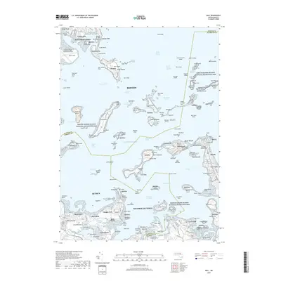
2018 Map of Hull
USGS Topo · Published 2018About this map
Boston Harbor Islands National Recreation Area dominates the marine landscape, showcasing the complex defensive history of the Massachusetts coastline. The map details a network of historic fortifications including Fort Warren on Georges Island, Fort Andrews on Peddocks Island, and Fort Revere on Telegraph Hill in Hull. These military installations, along with Fort Duvall near Bayside, once stood as primary sentinels for the harbor's shipping channels like President Roads and Nantasket Roads. Along the southern shore, the peninsula of Houghs Neck and the neighborhood of Germantown reveal the dense residential patterns of Quincy. To the north, the industrial and transport infrastructure of General Edward Lawrence Logan International Airport and Deer Island contrast with the recreational beaches of Wollaston Beach and Yirrell Beach, illustrating the multifaceted use of this coastal corridor.
Find a feature on this map
229 named features on this map. Tap any name to fly to it.
Don’t see what you’re looking for? This feature index may not catch every label — zoom into the map to look around manually.
Map Details
Editions of this 2018 Hull Map
This is the sole edition of this map. No revisions or reprints were ever made.
Other maps of this area

1885 · Abington
USGS Topo · 1:62,500

1886 · Dedham
USGS Topo · 1:62,500

1888 · Abington
USGS Topo · 1:62,500

1892 · Boston Bay
USGS Topo · 1:62,500

1893 · Abington
USGS Topo · 1:62,500

1893 · Boston
USGS Topo · 1:62,500

1894 · Dedham
USGS Topo · 1:62,500

1903 · Boston
USGS Topo · 1:62,500

1903 · Boston Bay
USGS Topo · 1:62,500

1919 · Dedham
USGS Topo · 1:62,500