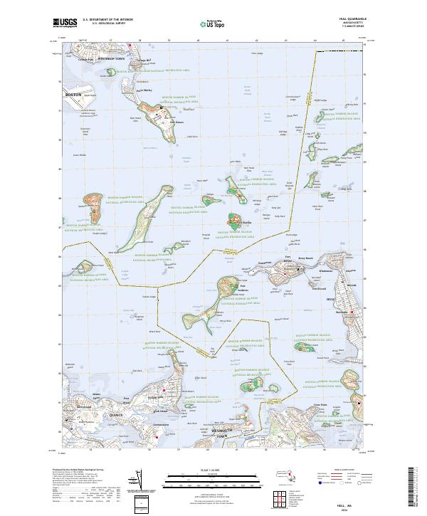
2024 Map of Hull
USGS Topo · Published 2024About this map
The Boston Harbor Islands National Recreation Area dominates this coastal survey, where a sophisticated network of navigational channels and historic defensive works protects the approach to the city. From the expansive grounds of the General Edward Lawrence Logan International Airport in the north to the residential peninsulas of Quincy and Weymouth Town in the south, the map illustrates the complex relationship between land and water. A string of fortified positions including Fort Warren, Fort Andrews, and Fort Dawes speaks to the harbor’s strategic importance, while distinct neighborhoods like Allerton, Pemberton, and Germantown line the shores. Extensive flats, such as Governors Island Flats and Deer Island Flats, are meticulously detailed alongside deep-water routes like President Roads and The Narrows, showing the modern maritime infrastructure of the Massachusetts coast.
Find a feature on this map
215 named features on this map. Tap any name to fly to it.
Don’t see what you’re looking for? This feature index may not catch every label — zoom into the map to look around manually.
Map Details
Editions of this 2024 Hull Map
This is the sole edition of this map. No revisions or reprints were ever made.
Other maps of this area

1885 · Abington
USGS Topo · 1:62,500

1886 · Dedham
USGS Topo · 1:62,500

1888 · Abington
USGS Topo · 1:62,500

1892 · Boston Bay
USGS Topo · 1:62,500

1893 · Abington
USGS Topo · 1:62,500

1893 · Boston
USGS Topo · 1:62,500

1894 · Dedham
USGS Topo · 1:62,500

1903 · Boston
USGS Topo · 1:62,500

1903 · Boston Bay
USGS Topo · 1:62,500

1919 · Dedham
USGS Topo · 1:62,500