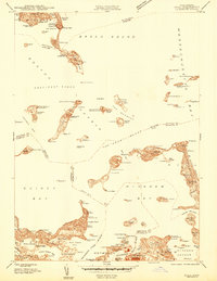
1944 Map of Hull
USGS Topo · Published 1944About this map
The islands of Boston Harbor and the defensive fortifications protecting the coast define this wartime survey. This preliminary edition shows a landscape heavily utilized for maritime defense and public service, from the Long Island Hospital to the strategic installations at Ft Warren and Ft Standish. The maritime character of the region is evident in the numerous social and industrial waterfront sites, including the Winthrop Yacht Club and the significant Bethlehem Hingham Shipyard along the Weymouth Back River.
Find a feature on this map
131 named features on this map. Tap any name to fly to it.
Don’t see what you’re looking for? This feature index may not catch every label — zoom into the map to look around manually.
Map Details
Editions of this 1944 Hull Map
This is the sole edition of this map. No revisions or reprints were ever made.
Other maps of this area

1885 · Abington
USGS Topo · 1:62,500

1886 · Dedham
USGS Topo · 1:62,500

1888 · Abington
USGS Topo · 1:62,500

1892 · Boston Bay
USGS Topo · 1:62,500

1893 · Abington
USGS Topo · 1:62,500

1893 · Boston
USGS Topo · 1:62,500

1894 · Dedham
USGS Topo · 1:62,500

1903 · Boston
USGS Topo · 1:62,500

1903 · Boston Bay
USGS Topo · 1:62,500

1919 · Dedham
USGS Topo · 1:62,500