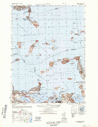
1948 Map of Hull
USGS Topo · Published 1948About this map
Ft Warren on Georges Island and Ft Andrews on Peddocks Island guard the strategic approaches to the harbor, defining the mid-century military landscape of these islands. The map highlights a coastal region defined by its island institutions and defensive batteries, from the House of Correction at Pt Shirley to the Long Island Hospital. The harbor's complex navigational network is clearly charted through landmarks like the Boston Lh and the Maritime Radio Training Station on Gallups Island. On the mainland, residential expansion is evident in established neighborhoods such as Houghs Neck, Merrymount, and Germantown. This survey captures the intricate relationship between the peninsula communities of Winthrop and Hull and the surrounding waters of Quincy Bay and Hingham Bay before the modern reconfiguration of many island facilities.
Find a feature on this map
103 named features on this map. Tap any name to fly to it.
Don’t see what you’re looking for? This feature index may not catch every label — zoom into the map to look around manually.
Map Details
Editions of this 1948 Hull Map
This is the sole edition of this map. No revisions or reprints were ever made.
Other maps of this area

1885 · Abington
USGS Topo · 1:62,500

1886 · Dedham
USGS Topo · 1:62,500

1888 · Abington
USGS Topo · 1:62,500

1892 · Boston Bay
USGS Topo · 1:62,500

1893 · Abington
USGS Topo · 1:62,500

1893 · Boston
USGS Topo · 1:62,500

1894 · Dedham
USGS Topo · 1:62,500

1903 · Boston
USGS Topo · 1:62,500

1903 · Boston Bay
USGS Topo · 1:62,500

1919 · Dedham
USGS Topo · 1:62,500