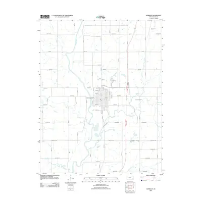
2012 Map of Humboldt
USGS Topo · Published 2012About this map
The Neosho River meanders through Allen County, defining the western edge of Humboldt and providing the setting for the local Humboldt Water Works. This grid-based settlement is anchored by the central Po and surrounded by a network of rural roads named for American states, such as Connecticut Rd and California Rd. For genealogists, the landscape is punctuated by numerous burial grounds, including the Dewitt Cem to the west and Saint Peter's Lutheran Cem to the southeast. Outside the main town, the smaller community of Fussman and the Allen County Airport reflect the area's continued infrastructure, while the Humboldt Speedway sits near the winding banks of Coal Cr, a tributary that feeds into the Neosho south of town.
Find a feature on this map
45 named features on this map. Tap any name to fly to it.
Don’t see what you’re looking for? This feature index may not catch every label — zoom into the map to look around manually.
Map Details
Editions of this 2012 Humboldt Map
This is the sole edition of this map. No revisions or reprints were ever made.
Other maps of this area

1886 · Fredonia
USGS Topo · 1:125,000

1886 · Iola
USGS Topo · 1:125,000

1893 · Iola
USGS Topo · 1:125,000

1894 · Fredonia
USGS Topo · 1:125,000

1904 · Iola
USGS Topo · 1:125,000

1938 · Altoona
USGS Topo · 1:62,500

1939 · Altoona
USGS Topo · 1:48,000

1943 · Altoona
USGS Topo · 1:62,500

1947 · Joplin
USGS Topo · 1:250,000

1949 · Joplin
USGS Topo · 1:250,000