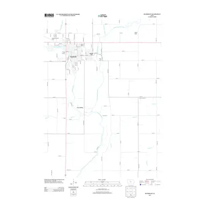
2013 Map of Humboldt
USGS Topo · Published 2013About this map
The confluence of the Des Moines River and the E Fork Des Moines River serves as the focal point for this Iowa landscape, where the neighboring communities of Humboldt and Dakota City are established. The map reveals a specialized local economy and infrastructure, featuring the Humboldt Fish Hatchery, the Humboldt County Fairgrounds, and the Humboldt County Dragway to the northeast. Beyond the primary residential centers, the rural grid is dotted with smaller named locales such as Addison, Jones Siding, and the Sylvan Retreat area along the riverbanks.
Find a feature on this map
95 named features on this map. Tap any name to fly to it.
Don’t see what you’re looking for? This feature index may not catch every label — zoom into the map to look around manually.
Map Details
Editions of this 2013 Humboldt Map
This is the sole edition of this map. No revisions or reprints were ever made.
Other maps of this area

1923 · Fort Dodge
USGS Topo · 1:62,500

1954 · Fort Dodge
USGS Topo · 1:250,000

1957 · Fort Dodge
USGS Topo · 1:250,000

1958 · Fort Dodge
USGS Topo · 1:250,000

1972 · Livermore
USGS Topo · 1:24,000
1972 · Hardy
USGS Topo · 1:24,000
1979 · Fort Dodge North
USGS Topo · 1:24,000
1979 · Thor
USGS Topo · 1:24,000

1979 · Humboldt
USGS Topo · 1:24,000

1979 · Clare
USGS Topo · 1:24,000