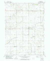
1979 Map of Thor
USGS Topo · Published 1979About this map
The town of Thor serves as the central hub of this agricultural landscape in the late 1970s, situated at the intersection of the Chicago and North Western railroad and local county thoroughfares. The terrain is defined by the winding paths of Beaver Creek and Soldier Creek, which cut through the townships of Norway and Beaver. This survey is particularly valuable for genealogists, as it meticulously documents numerous burial grounds including Norway Lake Cem, the adjacent East Ullensvang Cem and West Ullensvang Cem, and Blossom Hill Cem near the southern border. The transition from Humboldt and Webster counties is clearly marked, reflecting the organized township grid system of north-central Iowa. Scattered infrastructure like the Gas Well near the Newark township line highlights the rural utility and land use during this era of Midwestern farming.
Find a feature on this map
20 named features on this map. Tap any name to fly to it.
Don’t see what you’re looking for? This feature index may not catch every label — zoom into the map to look around manually.
Map Details
Editions of this 1979 Thor Map
2 editions found
Other maps of this area

1923 · Fort Dodge
USGS Topo · 1:62,500

1954 · Waterloo
USGS Topo · 1:250,000

1954 · Fort Dodge
USGS Topo · 1:250,000

1955 · Waterloo
USGS Topo · 1:250,000

1957 · Fort Dodge
USGS Topo · 1:250,000

1958 · Fort Dodge
USGS Topo · 1:250,000

1972 · Renwick
USGS Topo · 1:24,000

1972 · Livermore
USGS Topo · 1:24,000
1972 · Hardy
USGS Topo · 1:24,000

1978 · Eagle Grove SW
USGS Topo · 1:24,000