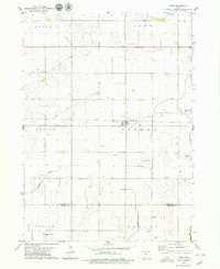
1979 Map of Thor
USGS Topo · Published 1979About this map
The settlement of Thor serves as the central hub of this agricultural landscape in the late 1970s, situated along the Chicago and North Western railroad line. The map reveals a highly engineered water management system essential for local farming, featuring an extensive network of drainage channels such as Ditch No 46, Ditch No 3, and Ditch No 9. These man-made features work in tandem with natural waterways like Beaver Creek and Soldier Creek to drain the fertile plains.
Find a feature on this map
25 named features on this map. Tap any name to fly to it.
Don’t see what you’re looking for? This feature index may not catch every label — zoom into the map to look around manually.
Map Details
Editions of this 1979 Thor Map
2 editions found
Other maps of this area

1923 · Fort Dodge
USGS Topo · 1:62,500

1954 · Waterloo
USGS Topo · 1:250,000

1954 · Fort Dodge
USGS Topo · 1:250,000

1955 · Waterloo
USGS Topo · 1:250,000

1957 · Fort Dodge
USGS Topo · 1:250,000

1958 · Fort Dodge
USGS Topo · 1:250,000

1972 · Renwick
USGS Topo · 1:24,000

1972 · Livermore
USGS Topo · 1:24,000
1972 · Hardy
USGS Topo · 1:24,000

1978 · Eagle Grove SW
USGS Topo · 1:24,000