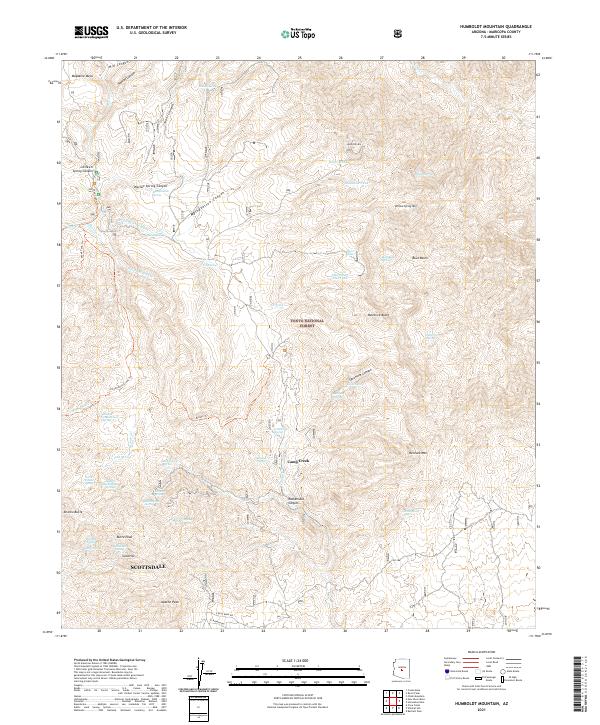
2021 Map of Humboldt Mountain
USGS Topo · Published 2021About this map
Tonto National Forest defines the rugged topography of this Maricopa County landscape, where numerous springs and tanks provided vital water sources in an arid environment. The settlement at Camp Creek serves as a focal point among high elevations like Humboldt Mtn and Willow Spring Mtn. Historical water access is documented through features such as Seven Springs, Mashakattee Spring, and Lopez Spring, which are scattered throughout complex drainages like Sycamore Canyon and Rackensack Canyon. The presence of several named peaks including Apache Peak, Butte Peak, and Gold Hill suggests a history of prospecting and ranching. The map also traces established paths like the Skunk Tank Trl and Bronco Trl, reflecting long-standing movement through the canyons north of Scottsdale.
Find a feature on this map
79 named features on this map. Tap any name to fly to it.
Don’t see what you’re looking for? This feature index may not catch every label — zoom into the map to look around manually.
Map Details
Editions of this 2021 Humboldt Mountain Map
This is the sole edition of this map. No revisions or reprints were ever made.
Other maps of this area

1887 · Verde
USGS Topo · 1:250,000

1892 · Verde
USGS Topo · 1:250,000

1929 · Turret Peak
USGS Topo · 1:125,000

1930 · Cave Creek
USGS Topo · 1:125,000

1933 · Turret Peak
USGS Topo · 1:125,000

1939 · Cave Creek
USGS Topo · 1:125,000

1954 · Holbrook
USGS Topo · 1:250,000

1954 · Mesa
USGS Topo · 1:250,000

1957 · Mesa
USGS Topo · 1:250,000

1957 · Holbrook
USGS Topo · 1:250,000