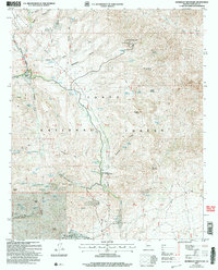
2004 Map of Humboldt Mountain
USGS Topo · Published 2006About this map
Humboldt Mountain stands as a prominent landmark in this section of the Tonto National Forest, crowned by a Lookout Tower and a Communication Site. The landscape is defined by its complex network of water sources, including Seven Springs, Mashakattee Spring, and Columbine Spring, which likely supported early ranching operations. Human activity is evidenced by established outposts like the Cartwright Ranch and Sears Kay Ranch, alongside modern developments such as the Tonto Hills (Subdivision) and the Camp Creek (Rec Residence Area). The transition from rugged resource extraction to residential and recreational land use is visible, with several unnamed Mines and Prospects scattered across the terrain near Rackensack Canyon and Butte Peak. This survey provides a precise look at the 20th-century infrastructure and topography before further modern expansion altered the character of this Maricopa County backcountry.
Find a feature on this map
57 named features on this map. Tap any name to fly to it.
Don’t see what you’re looking for? This feature index may not catch every label — zoom into the map to look around manually.
Map Details
Editions of this 2004 Humboldt Mountain Map
This is the sole edition of this map. No revisions or reprints were ever made.
Other maps of this area

1887 · Verde
USGS Topo · 1:250,000

1892 · Verde
USGS Topo · 1:250,000

1929 · Turret Peak
USGS Topo · 1:125,000

1930 · Cave Creek
USGS Topo · 1:125,000

1933 · Turret Peak
USGS Topo · 1:125,000

1939 · Cave Creek
USGS Topo · 1:125,000

1954 · Holbrook
USGS Topo · 1:250,000

1954 · Mesa
USGS Topo · 1:250,000

1957 · Mesa
USGS Topo · 1:250,000

1957 · Holbrook
USGS Topo · 1:250,000