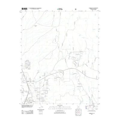
2012 Map of Humboldt
USGS Topo · Published 2012About this map
Dewey and Humboldt anchor this part of the Agua Fria River valley, reflecting a settlement pattern deeply tied to the local water sources and the surrounding terrain. The Agua Fria River meanders through the western section, while a dense network of washes and gulches like Yarber Wash, Grapevine Gulch, and Green Gulch drain the higher elevations. This landscape is marked by numerous named water features essential to life in this arid region, including Pine Flat Spring, Tex Canyon Tank, and Bruce Spring. Local history and genealogy interest is centered around the Henderson Cem and Humboldt Cem, which stand as landmarks for the community. The map details a transition from established residential streets like Madrid St and E Prescott St to the more open ranching and mining country defined by forest roads and drainage basins, illustrating the enduring relationship between the small Arizona towns and the physical geography of Yavapai County.
Find a feature on this map
112 named features on this map. Tap any name to fly to it.
Don’t see what you’re looking for? This feature index may not catch every label — zoom into the map to look around manually.
Map Details
Editions of this 2012 Humboldt Map
This is the sole edition of this map. No revisions or reprints were ever made.
Other maps of this area

1887 · Prescott
USGS Topo · 1:250,000

1892 · Prescott
USGS Topo · 1:250,000

1903 · Bradshaw Mountains
USGS Topo · 1:125,000

1905 · Jerome
USGS Topo · 1:125,000

1944 · Mingus Mountain
USGS Topo · 1:62,500

1947 · Mingus Mtn
USGS Topo · 1:62,500

1947 · Mayer
USGS Topo · 1:62,500

1947 · Mt. Union
USGS Topo · 1:62,500

1947 · Prescott
USGS Topo · 1:62,500

1948 · Mt. Union
USGS Topo · 1:63,360