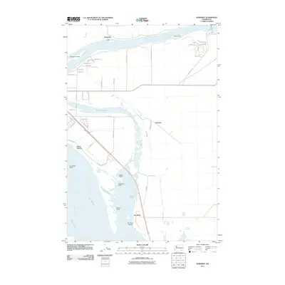
2011 Map of Humorist
USGS Topo · Published 2011About this map
The Snake River and Columbia River converge in this corner of Franklin County, defining a landscape shaped by water management and transit. At the northern edge, the Ice Harbor Lock and Dam controls the flow of the Snake River, creating Lake Sacajawea and supporting a series of islands including Goose Island and Strawberry Island. The confluence area near Two Rivers is characterized by extensive wetlands and ponds such as Curlew Pond and Quarry Pond, which separate the mainland from Peavine Island and Two Rivers Islands.
Find a feature on this map
53 named features on this map. Tap any name to fly to it.
Don’t see what you’re looking for? This feature index may not catch every label — zoom into the map to look around manually.
Map Details
Editions of this 2011 Humorist Map
This is the sole edition of this map. No revisions or reprints were ever made.
Other maps of this area

1915 · Wallulah
USGS Topo · 1:96,000

1917 · Pasco
USGS Topo · 1:125,000

1918 · Wallula
USGS Topo · 1:125,000

1953 · Walla Walla
USGS Topo · 1:250,000

1958 · Walla Walla
USGS Topo · 1:250,000

1964 · Wallula
USGS Topo · 1:24,000

1964 · Zangar Junction
USGS Topo · 1:24,000

1964 · Levey SW
USGS Topo · 1:24,000

1964 · Levey SE
USGS Topo · 1:24,000

1964 · Slater
USGS Topo · 1:24,000