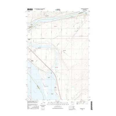
2017 Map of Humorist
USGS Topo · Published 2017About this map
The confluence of major Pacific Northwest waterways dominates this landscape where the Columbia River meets the Snake River south of Martindale. This 2017 survey details the complex hydraulic environment of the Tri-Cities region, featuring Lake Wallula and the lower reaches of Lake Sacajawea. The area around Burbank and Burbank Heights is characterized by a network of smaller water bodies and islands, including Burbank Slough, Tanglefoot Island, and Peavine Island. The presence of the High Lift Canal and various ponds like Quarry Pond and Curlew Pond indicates the intensive water management and industrial activity near Two Rivers. Transportation patterns are anchored by rail and road intersections at Villard Junction and the small settlement of Humorist, illustrating the region's role as a vital junction for inland commerce and irrigation infrastructure.
Find a feature on this map
68 named features on this map. Tap any name to fly to it.
Don’t see what you’re looking for? This feature index may not catch every label — zoom into the map to look around manually.
Map Details
Editions of this 2017 Humorist Map
This is the sole edition of this map. No revisions or reprints were ever made.
Other maps of this area

1915 · Wallulah
USGS Topo · 1:96,000

1917 · Pasco
USGS Topo · 1:125,000

1918 · Wallula
USGS Topo · 1:125,000

1953 · Walla Walla
USGS Topo · 1:250,000

1958 · Walla Walla
USGS Topo · 1:250,000

1964 · Wallula
USGS Topo · 1:24,000

1964 · Zangar Junction
USGS Topo · 1:24,000

1964 · Levey SW
USGS Topo · 1:24,000

1964 · Levey SE
USGS Topo · 1:24,000

1964 · Slater
USGS Topo · 1:24,000