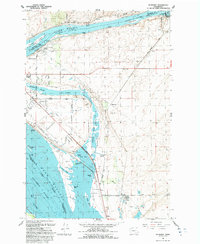
1992 Map of Humorist
USGS Topo · Published 1992About this map
Lake Wallula and the Snake River converge at the heart of this region, where the Mc nary National Wildlife Refuge preserves a complex network of wetlands and islands. The landscape is defined by the managed waters of the Columbia basin, featuring the Ice Harbor Lock and Dam and numerous ponds like Casey Pond and Curlew Pond. This 1990s record captures the industrial and agricultural infrastructure essential to the area, including the High Lift Canal, several pumping stations, and a large Feedlot near Two Rivers.
Find a feature on this map
42 named features on this map. Tap any name to fly to it.
Don’t see what you’re looking for? This feature index may not catch every label — zoom into the map to look around manually.
Map Details
Editions of this 1992 Humorist Map
This is the sole edition of this map. No revisions or reprints were ever made.
Other maps of this area

1915 · Wallulah
USGS Topo · 1:96,000

1917 · Pasco
USGS Topo · 1:125,000

1918 · Wallula
USGS Topo · 1:125,000

1953 · Walla Walla
USGS Topo · 1:250,000

1958 · Walla Walla
USGS Topo · 1:250,000

1964 · Wallula
USGS Topo · 1:24,000

1964 · Zangar Junction
USGS Topo · 1:24,000

1964 · Levey SW
USGS Topo · 1:24,000

1964 · Levey SE
USGS Topo · 1:24,000

1964 · Slater
USGS Topo · 1:24,000