
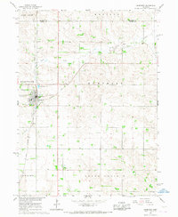
1966 Map of Humphrey SE
USGS Topo · Published 1968About this map
Shell Creek and its tributary Loseke Creek define the agricultural landscape of this eastern Nebraska region during the mid-1960s. The terrain is divided into the organized townships of Sherman, Shell Creek, and Bismark, following the survey lines established by the Sixth Principal Meridian. This map records a landscape deeply rooted in rural community life, marked by scattered schoolhouses such as School No 10 and School No 2, as well as the Schaad school site. Religious and memorial landmarks like Christ Ch, St Johns Ch, and Calvary Cem serve as focal points for local genealogy and history. Along the southern watercourse, a Gaging Station monitors the flow of the creek as it meanders toward the border of Platte and Colfax Counties.
Find a feature on this map
14 named features on this map. Tap any name to fly to it.
Don’t see what you’re looking for? This feature index may not catch every label — zoom into the map to look around manually.
Map Details
Editions of this 1966 Humphrey SE Map
This is the sole edition of this map. No revisions or reprints were ever made.
Other maps of this area

1899 · David City
USGS Topo · 1:125,000

1955 · Fremont
USGS Topo · 1:250,000

1957 · Fremont
USGS Topo · 1:250,000

1958 · Fremont
USGS Topo · 1:250,000

1958 · Duncan
USGS Topo · 1:24,000

1958 · Columbus
USGS Topo · 1:24,000

1966 · Clarkson SW
USGS Topo · 1:24,000

1966 · Platte Center
USGS Topo · 1:24,000

1966 · Creston
USGS Topo · 1:24,000
1966 · Humphrey
USGS Topo · 1:24,000