
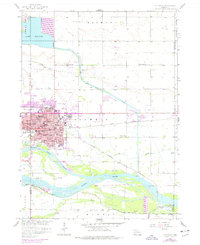
1958 Map of Columbus
USGS Topo · Published 1959About this map
Columbus sits at the vital confluence where the Loup River meets the braided channels of the Platte River. By the late 1950s, the city displays a dense civic infrastructure, including multiple neighborhood schools like Emerson Sch and Williams Sch, alongside central landmarks such as Fountain Square and Buffalo Square. The industrial and transportation character of the region is defined by the Union Pacific and Chicago Burlington and Quincy railroads, which parallel the river systems. North of the city, hydraulic engineering is evident in the massive Levee and Spoil Bank system surrounding Lake Babcock, feeding the Powerplant near the river bend. The map also records rural education through outlying sites like School No 80 and School No 44, while the local leisure culture of the era is captured by the Drive-in Theater and Pawnee Park.
Find a feature on this map
52 named features on this map. Tap any name to fly to it.
Don’t see what you’re looking for? This feature index may not catch every label — zoom into the map to look around manually.
Map Details
Editions of this 1958 Columbus Map
2 editions found
Other maps of this area

1899 · David City
USGS Topo · 1:125,000

1955 · Fremont
USGS Topo · 1:250,000

1957 · Fremont
USGS Topo · 1:250,000

1958 · Fremont
USGS Topo · 1:250,000

1958 · Duncan
USGS Topo · 1:24,000

1958 · Columbus SW
USGS Topo · 1:24,000

1958 · Columbus SE
USGS Topo · 1:24,000

1966 · Clarkson SW
USGS Topo · 1:24,000

1966 · Platte Center
USGS Topo · 1:24,000

1966 · Humphrey SE
USGS Topo · 1:24,000
Featured Places
- Columbus, NE
- Carriage House Estates, Columbus
- Country Mobile Villa, NE
- Platte County, NE
- Polk County, NE