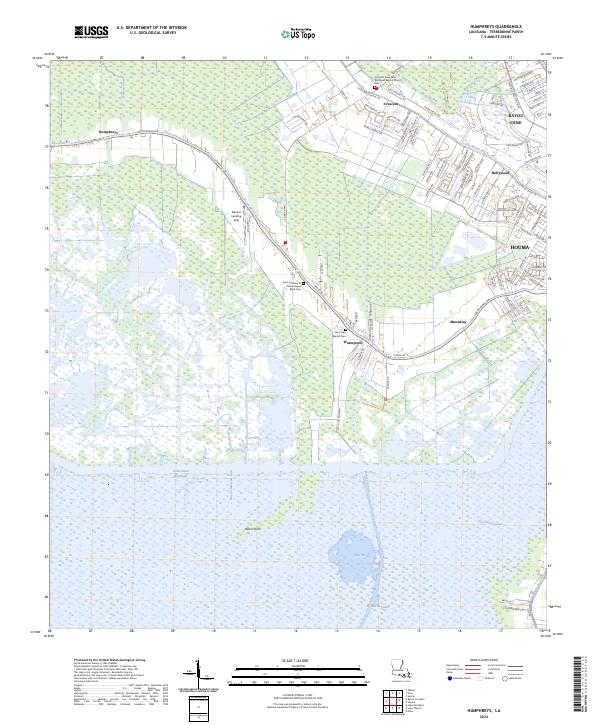
2024 Map of Humphreys
USGS Topo · Published 2024About this map
The Intracoastal Waterway and a dense network of canals like Minors Canal and Duplantis Canal define the watery geography of this Terrebonne Parish region. This landscape transitions from the urban edge of western Houma and Hollywood to the sprawling protected wetlands of the Mandalay National Wildlife Refuge. Along the winding path of Bayou Black, historic communities such as Humphreys and Crescent remain centered on the high ground near the water's edge, where the Crescent Farm-Saint Matthews Baptist Church Cem and Saint Luke Baptist Cem provide vital touchpoints for local family history. The presence of the Kelley Oil Company and the Daneco Landing Strip underscores the industrial and logistical activities that support the region's coastal economy. To the south, the terrain opens into vast aquatic expanses like Lake Hatch and Bayou Mauvais Bois, illustrating the intricate balance between human settlement and the Louisiana marsh.
Find a feature on this map
100 named features on this map. Tap any name to fly to it.
Don’t see what you’re looking for? This feature index may not catch every label — zoom into the map to look around manually.
Map Details
Editions of this 2024 Humphreys Map
This is the sole edition of this map. No revisions or reprints were ever made.
Other maps of this area

1892 · Gibson
USGS Topo · 1:62,500

1892 · Houma
USGS Topo · 1:62,500

1894 · Bayou De Large
USGS Topo · 1:62,500

1894 · Dulac
USGS Topo · 1:62,500

1897 · Gibson
USGS Topo · 1:62,500

1932 · Houma SW
USGS Topo · 1:31,680

1932 · Houma NW
USGS Topo · 1:31,680

1935 · Theriot
USGS Topo · 1:31,680

1935 · Lake Gero
USGS Topo · 1:31,680

1935 · Lake Penchant
USGS Topo · 1:31,680