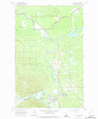
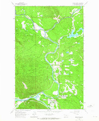
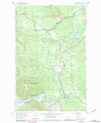
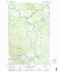
1962 Map of Hungry Horse
USGS Topo · Published 1975About this map
The Middle Fork Flathead River serves as the dividing line between Glacier National Park and the Flathead National Forest in this 1960s study. The map documents a landscape defined by the convergence of the Middle and South Fork Flathead River, which flow together near the community of Hungry Horse. This river network and the adjacent Great Northern railway shaped the development of the corridor, providing the primary access through the dramatic passage of Badrock Canyon.
Find a feature on this map
24 named features on this map. Tap any name to fly to it.
Don’t see what you’re looking for? This feature index may not catch every label — zoom into the map to look around manually.
Map Details
Editions of this 1962 Hungry Horse Map
4 editions found
Other maps of this area

1904 · Chief Mountain
USGS Topo · 1:125,000

1906 · Kintla Lakes
USGS Topo · 1:125,000

1914 · Nyack
USGS Topo · 1:125,000

1938 · Chief Mountain
USGS Topo · 1:125,000

1938 · Kintla Lakes
USGS Topo · 1:125,000

1943 · Kalispell
USGS Topo · 1:125,000

1957 · Kalispell
USGS Topo · 1:250,000

1960 · Kalispell
USGS Topo · 1:250,000

1960 · Cut Bank
USGS Topo · 1:250,000

1961 · Kalispell
USGS Topo · 1:250,000