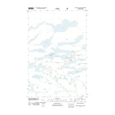
2011 Map of Hungry Jack Lake
USGS Topo · Published 2011About this map
Rose Lake marks the international border in this aquatic landscape of the early twenty-first century. The area is defined by a dense network of connected water bodies, where recreational outposts like Hungry Jack Lodge and Campground serve as central hubs for backcountry access. A series of forest roads and trails, such as Lima Grade and Needham Rd, provide the only terrestrial links between the numerous lakes that dominate the terrain, including Duncan Lake, Daniels Lake, and Bearskin Lake.
Find a feature on this map
52 named features on this map. Tap any name to fly to it.
Don’t see what you’re looking for? This feature index may not catch every label — zoom into the map to look around manually.
Map Details
Editions of this 2011 Hungry Jack Lake Map
This is the sole edition of this map. No revisions or reprints were ever made.
Other maps of this area

1919 · Brule Lake
USGS Topo · 1:62,500

1954 · Two Harbors
USGS Topo · 1:250,000

1957 · Two Harbors
USGS Topo · 1:250,000

1957 · Quetico
USGS Topo · 1:250,000

1958 · Two Harbors
USGS Topo · 1:250,000

1959 · Pine Mountain
USGS Topo · 1:24,000

1959 · Lima Mountain
USGS Topo · 1:24,000

1959 · Hungry Jack Lake
USGS Topo · 1:24,000

1959 · Crocodile Lake
USGS Topo · 1:24,000
1960 · South Lake
USGS Topo · 1:24,000