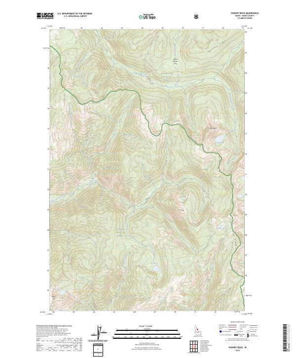
2024 Map of Hungry Rock
USGS Topo · Published 2024About this map
The Selway-Bitterroot Wilderness defines this section of Idaho County, where the transition between the Clearwater National Forest and the Nez Perce National Forest creates a landscape of high-elevation basins and steep divides. Dramatic topographical landmarks like Hungry Rock and Fox Peak overlook a network of alpine waters, including Hungry Lake, Maple Lake, and Isaac Lake. The drainage patterns are established by the North Fork Moose Creek and the headwaters of Warm Springs Creek, which flows near the prominent Warm Springs Pass. This modern record captures the hydrologic and topographic layout of a region where access is governed by natural features like Saturday Ridge and Maple Lake Ridge. While the map reflects contemporary management boundaries, it preserves the traditional place names of the mountain interior, from Bailey Mtn to Dodge Lake, essential for understanding the geographic orientation of this backcountry wilderness.
Find a feature on this map
25 named features on this map. Tap any name to fly to it.
Don’t see what you’re looking for? This feature index may not catch every label — zoom into the map to look around manually.
Map Details
Editions of this 2024 Hungry Rock Map
This is the sole edition of this map. No revisions or reprints were ever made.
Other maps of this area

1911 · Lolo
USGS Topo · 1:250,000

1913 · Lolo
USGS Topo · 1:250,000

1956 · Hamilton
USGS Topo · 1:250,000

1959 · Hamilton
USGS Topo · 1:250,000

1960 · Hamilton
USGS Topo · 1:250,000

1964 · Hamilton
USGS Topo · 1:250,000

1966 · Mc Connell Mtn
USGS Topo · 1:24,000

1966 · Grave Peak
USGS Topo · 1:24,000
1966 · Wahoo Peak
USGS Topo · 1:24,000
1966 · Freeman Peak
USGS Topo · 1:24,000