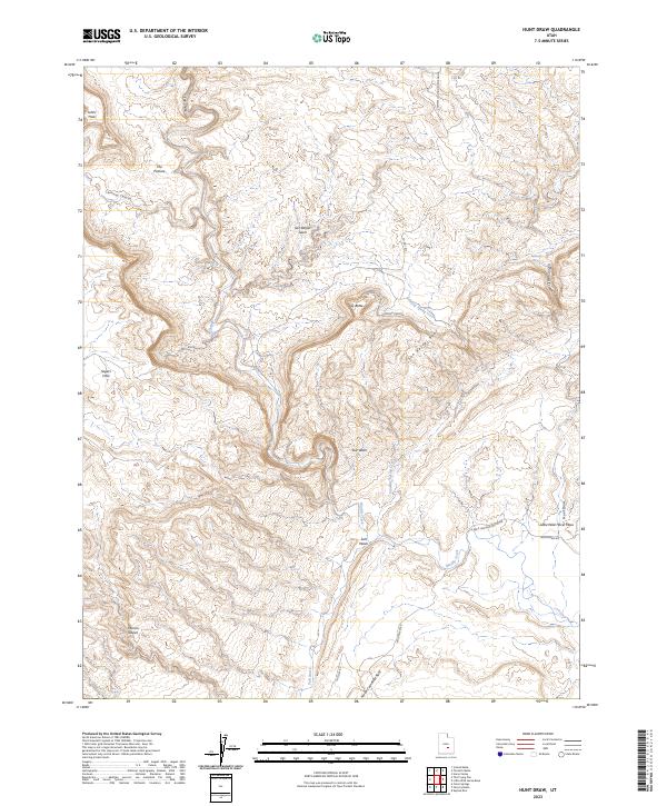
2023 Map of Hunt Draw
USGS Topo · Published 2023About this map
San Rafael Swell dominates this portion of Emery County, where the desert floor is carved by intricate drainage systems and dramatic uplift. The map highlights the transition from the high-relief San Rafael Reef to the sweeping Moroni Slopes in the southwest. Water, though scarce, has defined the landscape, with Muddy Creek and Salt Wash cutting through the arid terrain. Notable landmarks like Sy Butte and the sheer walls of Chimney Canyon provide clear orientation points within this complex topography. The presence of The Chute and the Cistern Canyon system suggests the historical importance of finding natural passage through these barriers, while names like The Pasture and Johns Hole hint at early grazing and local use of the more sheltered pockets of the desert.
Find a feature on this map
24 named features on this map. Tap any name to fly to it.
Don’t see what you’re looking for? This feature index may not catch every label — zoom into the map to look around manually.
Map Details
Editions of this 2023 Hunt Draw Map
This is the sole edition of this map. No revisions or reprints were ever made.
Other maps of this area

1885 · San Rafael
USGS Topo · 1:250,000

1885 · Fish Lake
USGS Topo · 1:250,000

1896 · Fish Lake
USGS Topo · 1:250,000

1952 · Wild Horse
USGS Topo · 1:62,500

1953 · Emery 4 NE
USGS Topo · 1:24,000

1953 · Emery 4 SE
USGS Topo · 1:24,000

1954 · Stinking Spring Creek 3 NW
USGS Topo · 1:24,000

1954 · Stinking Spring Creek 3 SE
USGS Topo · 1:24,000

1954 · Stinking Spring Creek 3 SW
USGS Topo · 1:24,000
1954 · Stinking Spring Creek 3 NE
USGS Topo · 1:24,000