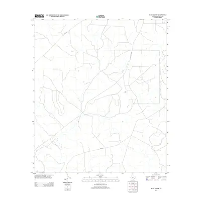
2012 Map of Hunt Ranch
USGS Topo · Published 2012About this map
Hunt Ranch serves as the namesake and primary landmark of this West Texas landscape, located in the arid terrain of Crockett County. This 2012 survey illustrates the sparse but vital infrastructure of the Edwards Plateau, where the land is largely defined by cattle and sheep ranching operations. The area is accessed via a network of rural routes, including Ranch Road 2083, which cuts through the central portion of the quadrangle. Other unpaved paths, such as Co Rd 403 in the northwest and Co Rd 401 in the south, highlight the connectivity required for large-scale ranching. The cartography reveals a pattern of ephemeral drainage and seasonal stream beds that carve through the plateau, emphasizing the importance of specific ranching outposts like the Hunt Ranch complex in this dry environment.
Find a feature on this map
4 named features on this map. Tap any name to fly to it.
Don’t see what you’re looking for? This feature index may not catch every label — zoom into the map to look around manually.
Map Details
Editions of this 2012 Hunt Ranch Map
This is the sole edition of this map. No revisions or reprints were ever made.
Other maps of this area

1954 · Sonora
USGS Topo · 1:250,000

1958 · Sonora
USGS Topo · 1:250,000

1967 · Ozona
USGS Topo · 1:24,000

1967 · Baggett Ranch
USGS Topo · 1:24,000

1967 · Pikes Peak
USGS Topo · 1:24,000

1967 · Hunt Ranch
USGS Topo · 1:24,000
1967 · Mitchell Canyon NE
USGS Topo · 1:24,000

1967 · Mitchell Canyon
USGS Topo · 1:24,000

1970 · Howards Well NE
USGS Topo · 1:24,000

1970 · Howards Well
USGS Topo · 1:24,000